SCBPT
South Carolina Battleground Preservation Trust
Berkeley County
The Path to Liberty

The Battleground Trust is pulling together several projects to focus on the Revolutionary War in Berkeley County for the next year. We have earlier announced that we have received a grant for 2015/2016 to document and map Revolutionary War battles in the county. This will, for the first time, develop the Berkeley County story to interpret to the public.
In addition to the grant research, the Battleground Trust is developing a smart phone/tablet driving tour of Revolutionary War sites in Berkeley County. The Revolutionary War history of the county is immense and there are many sites that can be visited and enjoyed by the public.
Lastly, the Battleground Trust is working with the Lord Berkeley Conservation Trust on an exciting project to acquire eighty acres of land which includes an extant British Revolutionary War fortification. There will be a major announcement in the upcoming months on this project.
Battlefield Documentation
Grant - Berkeley County

In late July, the National Park Service in Washington, DC announced their 2015 grant awards through the American Battlefield Protection Program (ABPP). The South Carolina Battleground Preservation Trust was awarded a grant of $74,000, making this the second year in a row that the Trust has received an ABPP grant.
The project will create a master database of battlefields and associated sites in Berkeley County, South Carolina. The goals of the project are to: 1) identify the historic battlefield sites in Berkeley County; 2) coordinate with the SC Department of Archives & History to nominate qualifying sites for listing on the National Register of Historic Places; and 3) develop a preservation plan for any unprotected sites. The Trust will analyze each battle using a military terrain analysis endorsed by the National Park Service.
The Berkeley County Revolutionary War Battles include:
April 14, 1780 Battle of Moncks Corner
May 6, 1780 Battle of Lenud’s Ferry
1781 Battle of Lewisfield Plantation
January 24, 1781 Battle of Wadboo / Moncks Corner
January 31, 1781 Attack on Kitfield Plantation
July 16, 1781 Battle of Biggin Bridge
July 17, 1781 Battle of Quinby Bridge
September 10, 1781 Retreat from Eutaw Springs
November 17, 1781 Battle of Fair Lawn Barony
December 30, 1781 Battle of Cainhoy
January 3, 1782 Battle of Videau’s Bridge
February 19, 1782 Battle of Strawberry Ferry
February 24, 1782 Battle of Wambaw Bridge
August 29, 1782 Battle of Wadboo Barony (Avenue of the Cedars)
Given that we are in the midst of the Tri-Centennial of the Yemassee War, we could not resist adding a battle from that period to be studied as well.
1715 Attack on Chicken Plantation, Yemassee War
There will be a series of public meetings to be held in Berkeley County beginning with an inaugural presentation at the Berkeley County Government building at 7:00 pm on August 27. Periodic updates to keep the public fully informed will be available through additional meetings and through the Trust newsletter.
The Revolutionary War in Mount Pleasant
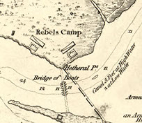
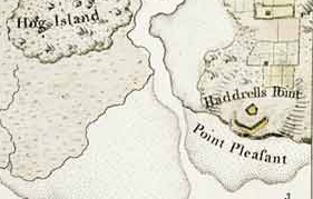
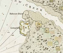
There was much activity in Christ Church Parish during the Revolutionary War. Mount Pleasant played a major role in the June 28, 1776, Battle of Fort Sullivan, the first significant Patriot victory of the war. Additionally, the Patriot fortifications in Mount Pleasant were attacked by the British through April 26—May 7, 1780.
In an interpretation project supported by the Town of Mount Pleasant, the South Carolina Battleground Preservation Trust is studying the Revolutionary War fortifications in the Parish to document their design features, history, types of guns in place at the fortifications, and recover any period maps. A 3D digital model will be created for each fortification. These models will be available to the public through the SCBPT website. They will also be made available to the Town and its Historical Commission for use and display. Additionally, the battles in 1776 and 1780 will be documented in a research report.
The Battleground Trust will make all of this research and models available through a web-based presentation that will launch in September 2015.
Drone Technology in Battlefield Preservation
It is, after all, the 21st century and a time when modern technology is exploding in the possibilities for ways to put it to use. The South Carolina Battleground Preservation Trust has been diligently studying battles during both the Revolutionary War and Civil War that occurred in Charleston and Jasper Counties. This study was funded by a generous grant from the American Battlefield Protection Program of the National Park Service.
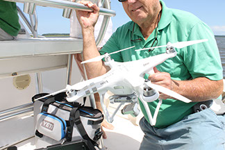
As we are wrapping up our interpretation and proofing the final reports, it occurred to us that seeing some of the battles from overhead would provide a unique experience in understanding the impact of the terrain on the battle. We called on our good friend and Battleground Trust member Dr. Norman Walsh (“Pard” to his friends) who is a talented photographer with his drone!

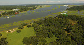
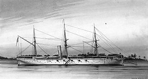
The first battle selected for this exercise was the Battle of Toogoodoo Creek, a fight between Union gunboats and three Confederate land batteries on February 9, 1865. In the battle, which lasted more than seven hours, the USS Daffodil, USS Sonoma, and the USS Pawnee entered Toogoodoo Creek to drag for torpedoes (mines). After entering the creek, the Pawnee maneuvered by running a “hawser to a tree for a spring.” This allowed the powerful gunboat to bring its broadside guns to bear on the three Confederate batteries along the creek. During the day-long battle, the Pawnee fired 382 shot and shell on the Confederate positions! Another 256 rounds were fired from the Sonoma. How did the battle turn out? Look for a narrated video of the Battle of Toogoodoo Creek featuring video taken by the drone to be linked on our Facebook page in late August.
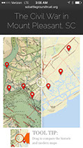
The Civil War in Mount Pleasant
There were seven defensive fortifications constructed in Mount Pleasant during the war:
• Battery Gary (Pitt Street)
• Hibben Street Battery
• Hobcaw Point Battery
• Hogg Island Battery (Patriots Point)
• Kinloch’s Landing Battery
• Venning’s Landing Battery
• Christ Church Lines & Fort Palmetto
Today, only the Christ Church Lines and Fort Palmetto have survived. In this project, sponsored by the Town of Mount Pleasant, the Battleground Trust located period designs, maps, and descriptions of the other six Mount Pleasant Civil War fortifications. Though these batteries are not extant, the research data allowed the Trust to create models of these fortifications as they appeared during the Civil War. These models and a short history of each is available to the public through a web-based presentation.
Click the image to the left to view the Civil War in Mount Pleasant.
Battlefield Documentation Grant – Charleston County & Berkeley County
In July 2014, the South Carolina Battleground Preservation Trust was awarded a grant by the National Park Service through the American Battlefield Protection Program (ABPP). This was the first grant awarded to the Battleground Trust by the ABPP.
The project was to create a master database of battlefields and associated sites in from the Revolutionary War and Civil War in Charleston and Jasper Counties. The goals of the project were to: 1) identify the historic battlefield sites in Charleston and Jasper Counties; 2) coordinate with the SC Department of Archives & History to nominate qualifying sites for listing on the National Register of Historic Places; and 3) develop a preservation plan for any unprotected sites. The Trust analyzed each battle using a military terrain analysis endorsed by the National Park Service.
Some of the battles included in this project were:
Revolutionary War:
May 3-4, 1779: Battle of Coosawhatchie (Jasper County)
May 10 – 12, 1779: Attack on Charles Town (Charleston County)
June 20, 1779: Battle of Stono Ferry (Charleston County)
April 26 – May 7, 1780: Attack on Mount Pleasant – Haddrell’s Point Battery & Lempriere’s Point Battery (Charleston County)
Civil War Battles:
April 29, 1862: Attack on Pineberry Battery (Charleston County)
May 29, 1862: 1st Battle of Pocotaligo (Beaufort & Jasper Counties)
June 24 – 27, 1962: The Battle of Blake’s Plantation (Charleston County)
October 22, 1862: 2nd Battle of Pocotaligo (Jasper County)
January 29, 1863: The Capture of the USS Isaac P. Smith (Charleston County)
December 25, 1863: Attack on the USS Marblehead
February 7 – 12, 1864: The Battle of Haulover Cut (Charleston County)
July 2 – 11, 1864: Foster’s Five-Pronged Attack on Charleston (Charleston County)
a) July 2 – 10, 1864: 3rd Battle of James Island
b) July 2/3, 1864: Amphibious assault on Fort Johnson and Battery Simkins
c) July 3 – 10, 1864: Attack on Battery Pringle
d) July 3 – 4, 1864: Battle of King’s Creek
e) July 6 – 9, 1864: Battle of Burden’s Causeway
December 6 – 9, 1864: Battle of Tulifinny Crossroads (Jasper County)
February 9, 1865: Battle of the Toogoodoo River (Charleston County)
February 11, 1865: Assault on Battery Simkins (Charleston County)
February 13 – 17, 1865: Attack on Christ Church Parish (Charleston County)
LiDAR Technology in Battlefield Preservation
Matt Luke joined our staff in 2013 and he brought with him an expertise in the application of LiDAR technology to battlefield and earthworks preservation. His Master’s thesis was AERIAL LIDAR IN THE ARCHAEOLOGICAL RECONNAISSANCE AND MAPPING OF CIVIL WAR EARTHEN FORTIFICATIONS. The Trust utilizes aerial LiDAR available from the US National Oceanic and Atmospheric Administration (NOAA), a division of the US Department of Commerce, and the SC Department of Natural Resources. In this example of an aerial LiDAR survey, you can clearly see a number of Civil War fortifications on John’s Island and James Island along the Stono River.
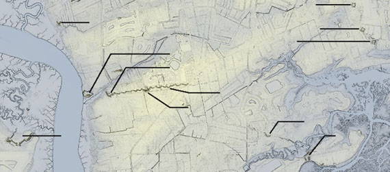
Fort Trenholm
Fort Pringle
Unnamed Battery
Battery #1
Battery Zero
Battery Tynes
Redoubt #3
Redoubt #2
Redoubt #1
Battery #5
Fort Lamar
In this aerial LiDAR image of Fort Lamar on James Island, the entire story of the Union defeat is told in this one image. Though the Union army advanced with an army that outnumbered the Confederates at Secessionville by the thousands, the image here clearly demonstrated they were marching into a telescoping field. While they had more than 6,000 troops available for the attack, the marsh on either side of the Secessionville peninsula creates a bottleneck right in front of the parapet of Fort Lamar. The impact of the terrain severely limited the number of Union troops that could be utilized in the attack and provided a great strategic advantage to Colonel Lamar and his Confederate troops. Understanding the terrain at Secessionville, it is not difficult to understand the Confederate victory in this battle.
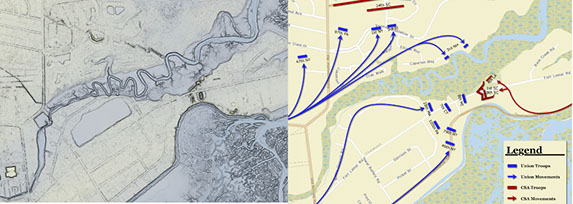
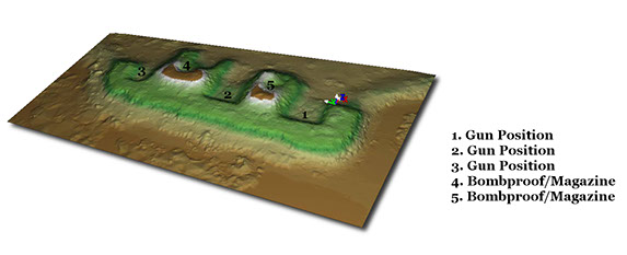
We also utilize terrestrial LiDAR. This is a ground-based LiDAR system that uses near-infrared light to measure and record the distance to a surface from the sensor position. The scan data is then processed in ArcGIS to generate a Digital Elevation Model (DEM), terrain dataset, and half-meter contour map for use in interpretative signage. In addition to generating a high resolution “as is” 3D model of the ground surface, the scan data also provides detailed measurements of the fortifications layout for use in creating an “as-built” model of the site. These are available through standard formats that can be made easily accessible to the public over the internet using freely available viewers. Behind the scenes, the LiDAR data also provides baseline map data for each site that is use in assessing a site’s level of preservation, monitoring erosion, and other preservation management activities. This model below is the “as is” model of Fort Palmetto in Mount Pleasant.
In the last year alone, the review of aerial LiDAR surveys of Charleston County has revealed a number of batteries that were unknown or thought to be destroyed.
